Tuesday, October 27, 2015

Day 27 - Nevada


Day 27:
Friday, October 23

Shoe Tree on RT 50

Back to civilization and that means grocery shopping, gas fill up before California$$, Cell phone service (aside from texting when it was possible, not much service on that highway 50 in Nevada)…errand day.  Fresh Water procured in Bob Scott Campground just east of Austin; we both liked this campground but didn’t spend the $10 to stay there even though no one was there.  Put it on the next time list to camp under the Ponderosa pines (not sure what they were).
Tonight’s overnight was supposed to be at Walmart in Fallon but when we got there and saw how noisy it was, we both wanted to get out of there ASAP and find somewhere else to stay.  We did quick shopping and were off to find a free place to dump our tanks.  Yerington, NV provided us with two possible free places to dump and we chose one.  Thank you Yerington for being RV friendly.  There was also a rest area there that we could have stayed and probably wouldn’t have had any truckers (they were in a lot across the street).  Their grocery store Solaris had a nice produce and meat selection.  Prices were reasonable (chicken was cheaper than walmart).

 We opted to find some place more quiet and hopefully scenic.  Wilson Canyon Trailhead provided us with scenic and quiet on lightly travelled route 208 in Nevada.


Few photos for this day...it is move day.

Day 22 - 26: October 18 - 22, 2015 The loneliest highway Nevada's route 50


Solar toys!  Courtesy of BLM dumpster
Day 22 - 26
October 18 – 22
We spent the next six days exploring route 50 in Nevada…Illipah Reservervoir to Fallon on the loneliest highway in Nevada.  Petroglyphs, hot springs, walking in the hills, and just enjoying the loneliest highway (no wifi service naturally) but we could text here and there.  It was very relaxing.
hiking in Nevada

tin can dump in nevada...must be a use for these!

hiking in nevada

awesome colors
happy man!

awesome Nevada views!

I am liking this lichen


Couldn't keep him out of this...

Nice soak and awesome views


Getting ready for a fire with wood he didn't have  to cut


Awesome Nevada

Nasty picture


The End

Day 21 - Illipah Reservoir, NV

Day 21:
October 17, 2015
Illipah Reservoir on Nevada's route 50 - our overnight
The space we selected to camp in last night in the dark was for wind protection (and a quiet night’s sleep from things clanging around) so this morning we moved down to the reservoir to have a look and check out the campsite options. 


 We are using our Mr. Buddy heater and David’s refilled propane canisters for heat each morning (unless we get going early and use the cab heat). An odd cloudy day in Nevada.Our short walk took us past the reservoir. We found the horses and cattle that were on the highway signs busy eating grasses at the reservoir.  I heard coyotes singing several times last night way off in the distance.  It started to drizzle, we turned around and made it just back to the rv before the sky opened up for a period of heavy rain.


Illipah pano

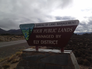
Notice WHOSE public lands these are!

Cute hugh!  David wanted this picture.

Land rainbow


The End


Day 20 - Great Basin National Park, NV


Day 20:
October 16, 2015
David's hike up Wheeler Peak in Great Basin NP
We got up early today to see the sunrise from wheeler peak parking lot @ 10,000 feet.  The road is restricted to vehicles 24 feet or less and we just made that cut off.
We departed at 5:30 am (dark) and did a slow crawl up the mountain to keep the transmission from overheating (and issue that David has plans to remedy with a transmission cooler when we return).  This also prevented a line of cranky drivers behind us (we will probably find them behind us on the way down…brakes overheating become and issue so we go in low and pull off the road as needed).

The altitude isn’t giving me enough oxygen for an 8.2 mile hike with 2900 feet of elevation gain so David is hiking Wheeler peak by himself.  Sometimes I am winded just existing, no kidding.

David’s hike afforded him excellent views.  A large portion of it was above tree line.
Some of the directional signage was not the best; he didn’t have a map.  The hike took him about 7.5 hours but he spent time on the summit oogling the views.  The ride down from 10,000 feet to the valley floor was uneventful.  We went slow and pulled off for cars behind us.  We drove by our campsite only to find a newer class A motorhome squeezed in there!  They had to have gotten some dings procuring that site!


After dumping our tanks and taking on fresh water we were off aiming for Illipah Reservoir for a free overnight.  We arrived after dark and neither of us was happy about driving in the dark.  With signs on route 50 warning of big things (like free ranging cattle/no fences and Elk) that might cross the dark roads and do serious damage to us and them, we were counting the miles until we arrived at the reservoir.   There appears to be only two other campers here out of potentially 14 sites and its Friday night.


Leaving Great Basin we saw this windmill farm...need
to have more of this!


The End

Day 19 - Utah and into Nevada's Great Basin National Park


Day 19:
October 15, 2015
Parowan Petroglyphs
Because Parowan Petroglyphs are on a back road, it was quiet from the moment we got there around 8:30 at night…maybe one car went by before we went to bed.  A handful of cars came through in the morning.


We took a walk to look at the petroglyphs (pecked into the rock)…an excellent display.  Down the road (to the east) were some dinosaur tracks and we backtracked to go look at them. There was not a lot of information there so in some areas we had no clue as to what we were supposed to be seeing…a little underwhelming and not very well maintained.  We probably could have spent the night there as well.


Our boon docking spot


Okay, this is supposed to be a dinosaur
foot print


Our campsite in Great Basin National Park
Drive to Great Basin National Park today and what a breathtaking scenery extravaganza it was on Utah route 130 to route 21.  Vast miles of mountain summits and deep wide valleys.  Open range country for horses (wild management) and cattle.  We saw two dead of each and since they were right next to road it was hit by vehicle and probably at night…the night sky rules here.  Would love to spend a night out here at some point.  Today we entered Nevada.
We are staying in Lower Lehman Campground at the National Park since it is the highest elevation campground that is open.  I don’t think anything much bigger than our 24/5 feet would fit in here as the trees are very close to the road.  SCRATCH THAT!  We have seen a 28-30 foot class C and 24 foot trailers whizzing by!  Good thing we got here early  because this campground is now full.  There are 11 campsites total in this campground and maybe half were occupied when we got here. Hey, this is also supposed to be the least visited National Park??? 

Aspens in our back yard AND a babbling brook. We hunted down some wood and made a nice campfire.  Lively game of polish poker.  To bed early for early rise to coax the motorhome into crawling up the mountain road to the trailhead for Wheeler Peak.  This is a no entry fee park.


The babbling brook behind our campsite

The End

Saturday, October 24, 2015

Day 18 - Cedar Breaks National Monument

Day 18:
Oct 14, 2015:
Red Canyon
When we got up this a.m. we weren’t quite sure what our route would be.  Since we knew we did really want to see Cedar Breaks National Monument that jelled our route.   This brought us through more of Dixie National Forest (love it).
We went through Red Canyon and decided next time to spend a night at the campground there.  There were numerous forest roads that we will next time explore (perhaps with a tow car/toad)  after a visit to one of their offices for best places for us to get into for free dispersed camping.  AND there is hardly anyone on route 143 and route 148 and in Cedar Breaks. We stopped at Panguich Lake for a short stroll and breakfast.  This georgeous scenery is all ours!  No Tour buses, one or two rental motorhomes.  Loving this!

Cedar Breaks hiking
We did one hike in Cedar Breaks (Alpine Pond) that was 2.2 miles and at an elevation of 10,460 feet worth of elevation…quite a difference for this girl from a few hundred feet above sea level (NY).  I was sucking oxygen a bit on that one but it was still enjoyable.  We had intended to do more except for the husband/wife  whom David struck up a conversation with whom just couldn’t stop talking.  I am not exaggerating here when I say she talked nonstop and it was hard to get a word in.  David had been “listening” for 15 minutes when I arrived.  I quickly realized that she was not going to quit…on and on and on.  I told him not to talk to strangers!  Finally we said we had to go and get our laundry done in Cedar City and didn’t let her say another word except good bye.  So I missed out on a hike…  He was driving rather fast after that…hoping they wouldn’t catch up.

Off to Cedar City and long downhill from Cedar Breaks….the kind that you need to put your rv in low for so your brakes don’t fry.  Cedar City brought civilization, grocery shopping, laundry, propane, gas, WIFI (woohoo) and tomorrow we will dump our tanks and refill on water.

After all those errands, it was getting dark and we weren’t going to make our intended night stop before dark.  We also did not want to overnight in the Walmart parking lot (too noisy).  So off we went anyway and after an error or two, we found our spot at Parowan Gap Petroglyphs.  Yes, we were the only ones there…again.  I think because it wasn’t JUST off I-15.  Can’t wait to see the petroglyphs in the light of morning.


Day 17 Utah - Bryce National Park

Day 17:
Oct 13, 2015:
A quiet night with the cows…
Today was Bryce National Park day.  Last night’s overnight parking spot was very close to Bryce so in 15 minutes we were at the visitor’s center.  We pretty much knew that we would come back another time through here so we gathered info and did a simple hike. 


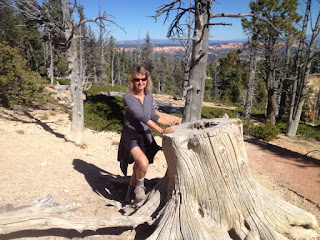
Walking in Bryce National Park
Next time we will come more prepared to spend at least one night in the park campground (David’s senior status will nab us ½ price then…) and concentrate on certain hikes that we both want to do.  I appears once you get on the longer hikes the crowds diminish dramatically.   We also found a backdoor access to one of the hikes that will enable us to not even have to stay in the park for one of the hikes.


The scenery/hoodoos here are quite outstanding – colorful and something that you don’t see in any other park.  I was Bryced out by 4pm and off we were to find our parking spot for the night.  About 15 minutes  from Brice we found our spot (so far it is just us) in Dixie National Forest (free dispersed camping in National Forests).  This is the first time we have used the National Forests and so far so good.  We have to pick and choose the road quality and make sure it is not 10 miles in, etc.  This one is only ½ from the road but easy access.


Yeah, it looked like just us there but there was a line of people
waiting to take this same shot...nothing like a national park!


We will be back to hike down in here:)